Located near the town of Beaufort, South Carolina, Parris Island holds more than the dreams of future Marines. It contains the remains of a Spanish fort erected in 1577 in the Spanish town of Santa Elena. For decades, attempts to find it have failed, and Fort San Marcos stayed hidden until new technology brought it to light.
In a paper published in the Journal of Archeology Science Reports, archaeologists led by the University of South Carolina’s Chester DePratter and UGA’s Victor Thompson discuss how they uncovered Fort San Marcos without scooping a shovelful of soil.
San Marcos is one of five Spanish forts built sequentially at Santa Elena over its 21-year occupation.
DePratter and Thompson have conducted research at Santa Elena since 2014 to locate the fort that was founded in 1577 by Pedro Menedez Marquez, the governor of Spanish La Florida. Their discovery sheds light on the oldest, most northern Spanish settlement in the Americas, built to thwart French exploration into the New World.
Marquez arrived in October 1577 at the abandoned town of Santa Elena with two ships carrying pre-fabricated posts and heavy planking. He erected Fort San Marcos in six days in defense against a possible Native American attack such as the one that forced the abandonment of the town a year earlier. The town had flourished, nearing 400 residents, since its establishment more than a decade earlier in 1566 by Pedro Menendez de Aviles, who had founded Spanish La Florida and St. Augustine the year before. In 1571, it became the capital of Spanish Florida, and it remained the capital until 1576.
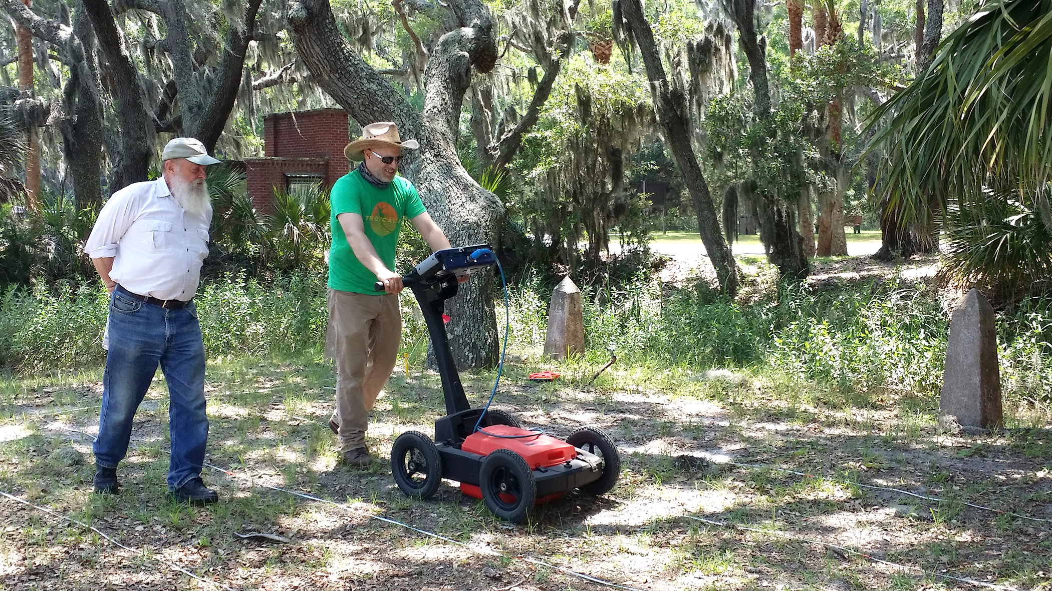
“I have been looking for San Marcos since 1993, and new techniques and technologies allowed for a fresh search,” said DePratter, who conducts research through USC’s South Carolina Institute for Archaeology and Anthropology in the College of Arts and Sciences.
DePratter said the general location of Fort San Marcos has been known for decades from documentary sources, which included a written description and drawing of the fort that are part of the Archive of the Indies in Seville, Spain. Several early attempts to find the fort through excavation failed.
In early June, DePratter and Thompson returned to Santa Elena to employ a suite of new remote sensing technologies to look below the surface of the ground without actually digging. Using ground penetrating radar, soil resistivity and magnetometers, they sent radar pulses and electric currents into the ground and measured differences in local magnetic fields in search of the missing fort and to map the lost 15-acre landscape of Santa Elena and the buildings that brought life to the early settlement.
“Santa Elena is providing once again an unprecedented view of the 16th-century landscape. This is one of the best sites for remote sensing that I’ve ever had the privilege to work on,” said Thompson, director of UGA’s Center for Archaeological Sciences and associate professor in the Franklin of College of Arts and Sciences anthropology department.
Santa Elena is the best preserved 16th century town in the country, DePratter said, in part because of its location, which is underneath a former military golf course that has no standing structures on it.
“This work will allow us to tell the story of the land that would eventually become the United States. Santa Elena is an important part of this history that lends insight into how colonial powers in Europe vied for control over this corner of the New World,” said Thompson.