
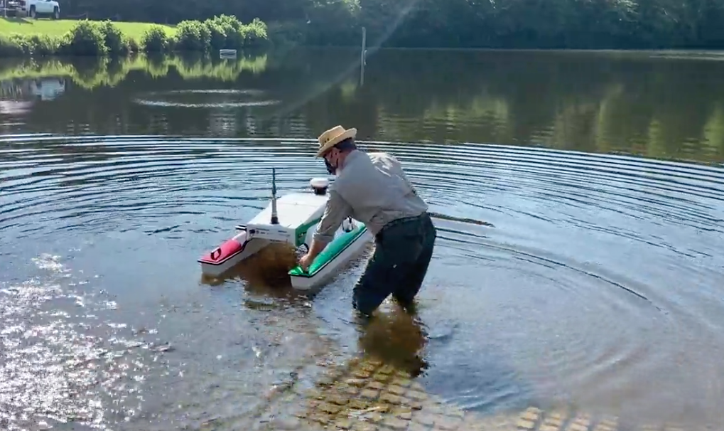
From the shore, you can hear a soft hum as the vessel cuts a line through the water.
Meanwhile, on the shore, University of Georgia graduate student Wes Gerrin keeps his eyes on a computer monitor and a controller that resembles something you might find with an Xbox. Typically, Gerrin would be in a boat monitoring equipment to get similar data, but driving this small craft is a vast improvement, he says.
The new ASV, or autonomous surface vessel, is the next generation of technology for collecting underwater data, and it’s now available to UGA students. UGA’s vessel allows researchers like Gerrin to analyze detailed information about aquatic health. When paired with similar technology on land, students can see a fuller picture of how land management affects water quality.
“We’re already doing a lot of things separately that this device will allow us to do in an integrated way,” said Jay Shelton, an associate professor of fisheries for the UGA Warnell School of Forestry and Natural Resources. “For example, we collect a great deal of water quality data … and a great deal of depth data using the sonar on a boat, as well as discharge and flow velocity. But what’s really awesome about this is, for the first time, we can do all of that, in an integrated way, with a software package that gives us the total picture without having to piece all of these different things together.”
Water quality projects
The ASV, which was purchased through UGA’s student technology funds grant program, is slightly smaller than a personal watercraft. But instead of taking people out onto the water, it’s designed to transport a suite of instruments. Because data is collected in one place, using one system, it’s invaluable for projects involving water quality—where land and water measurements combine to create the best picture of the area.
The new vessel will be immediately put to use surveying fish habitat on the floor of Lake Herrick, which reopened to paddleboats three years ago following restoration efforts by UGA. Since then, UGA students initiated a fish habitat improvement program using discarded Christmas trees provided by Athens-Clarke County. Gerrin says the ASV will be instrumental in surveying the trees and how fish populations use them.
“One of the other primary uses for this will be to get students involved in tracking the water quality in Lake Herrick over time, because we’re going to be able to characterize the entire waterbody and we can track the success of the university’s restoration project,” added Gerrin. “So, we’re going to have students from several classes from Warnell participate in one way or other in its use and demonstrate why those types of data are important and how they can use them in their careers.”
Gives a clearer picture
On a recent morning, as the ASV churned across Lake Herrick on its maiden voyage, Shelton stressed how this raises the bar in terms of information collected. Warnell faculty member Tripp Lowe has previously received student technology funds to purchase an unmanned aerial vehicle used to teach surveys and spatial data collection.
Now, by combining that technology with the ASV, students can see the full picture of how water quality can improve—or not—based on management and surrounding land use. Because runoff from the land directly affects the quality of the water, students will be able to understand concepts and solutions that lead to better management decisions.
“Before, I would say it wasn’t feasible to do that. … We didn’t have the technology to collect data synchronously for the entire system,” said Gerrin. “So, now we’re going to be able to get a clearer picture of what’s going on in the water and on land. It’s going to be a really cool tool.”