
Georgians are gaining easier access to valuable local information as more county governments take the benefits of Geographic Information Systems technology to the next level with assistance from the Carl Vinson Institute of Government.
“Between 2000 and 2005, our greatest challenge was convincing Georgia local governments that any investment in GIS technology was a wise choice,” states Chad Rupert of the Institute’s Information Technology Outreach Services division. “As the result of various GIS educational efforts and projects, most county governments now embrace the technology and accept its merits without question.”
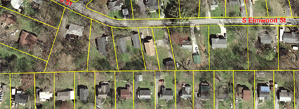
In building the capacity of Georgia local governments of all sizes to incorporate GIS technology into their operations and manage it efficiently, Rupert and his colleagues typically begin each project with some form of digital aerial photography, upon which a road centerline layer and parcel layer (property boundaries) are created and overlaid. These parcel layers form the foundation for other GIS layers like zoning, public safety districts, and voting districts.
Approximately 108 of the 159 counties in Georgia currently have their parcel data in the widely accepted GIS format called ESRI. Five other counties under GIS construction at this time are receiving Vinson Institute assistance: Catoosa County, Coweta County, Emanuel County, Fayette County, and Toombs County.
The latest opportunity facing the ITOS Local Government GIS Group has been educating those at the local government level who manage this data and their respective local officials about the benefits of making the electronic information available for public use.
“By placing GIS data on the Internet, citizens can go to their computers day or night and find data about their property assessments and how they are determined. They can see aerial photos of their land and gain a better understanding of their community,” explains Rupert. “Whether the information is used to satisfy curiosity or for serious business, local governments willing to make information easily accessible may be viewed as progressive and champions of open government,” explains Rupert.
With the number of counties using GIS technology growing at a rate of approximately five counties each year, Rupert and his colleagues believe that every Georgia county will likely be using GIS in the next 10 years. “The number of counties making their GIS data available via the Internet will accelerate as more of the public comes to expect it as a core service. It is likely that nearly every county in Georgia will have their GIS data on the Internet in the next 10 years,” he concludes.