Athens, Ga. – The University of Georgia College of Environment and Design and the UGA Department of Geography recently participated in the 2012 GeoDesign Summit in Redlands, Calif.
CED Assistant Professor Alison Bramlet, Associate Professor Cari Goetcheus, Master of Landscape Architecture candidate Wes Ryals and UGA Associate Director of the Center for Remote Sensing and Mapping Science Thomas R. Jordan spoke at the Summit. Created three years ago, the GeoDesign Summit is a “think tank conference” for multidisciplinary design professionals focusing on the evolution of technology that is at the intersection of design and geographic space.
The Summit’s organizer, Environmental Systems Research Institute, is an international company founded in 1969 as a land-use consulting firm. Today, ESRI is one of the world’s leading developers of software for Geographic Information Systems, the most well known of which is ArcGIS. Lawrie Jordan, a UGA alumnus, currently is the director of imagery at ESRI and has three decades of experience in image processing and remote sensing. Jordan has been an adviser to numerous organizations whose work depends on effective, detailed imagery-from disaster relief agencies, to land planners to the U.S. Department of Defense. He holds degrees in Landscape Architecture from UGA and Harvard’s Graduate School of Design.
Bramlet’s talk, titled “The Greenprints Project: How GIS Can Inform Design Decisions,” emphasized the role of stakeholder feedback in establishing a park, trail and open spaces for a comprehensive infrastructure system for the city of Woodstock. The Greenprints Project, initiated in 2007 by the Woodstock City Council and the Planning and Economic Development Department and led by Ecos Environmental Design of Atlanta, involved a nine-month planning process that incorporated community feedback into GIS analysis. Jack Dangermond, president of ESRI, commended Bramlet’s presentation of a real-world GeoDesign project.
Goetcheus, Jordan and Ryals presented “Understanding the Past, Charting the Future: GeoDesign Opportunities in Cultural Landscape Research, Documentation and Management.” Using examples from the UGA Cultural Landscape Lab (including projects in Wormsloe Plantation near Savannah, Hyde Farm in Cobb County and Stratford Hall in Westmoreland County, Va.), along with work Goetcheus has conducted on Gullah Geechee communities in South Carolina, the presentation reinforced how GeoDesign methods and technologies offer opportunities for holistic analysis and design for complex cultural landscapes. With a goal of limiting impact on historically or environmentally sensitive areas, these technologies help designers and planners make informed and sensitive decisions.
The highlight of the presentation was Jordan’s work integrating aerial and terrestrial LIDAR, or Light Detection and Ranging and Ryals’ work with Adobe Creative Suites software to assist in the documentation, analysis, evaluation and treatment of cultural landscapes. LIDAR uses laser technology and has applications in numerous disciplines, including archeology and geography, as well as landscape architecture. The team found LIDAR to be hugely helpful in revealing what is difficult to see through heavy canopied landforms, such as earthworks, while the Adobe Creative Suites software assists in visualization of projects before they are implemented. Jordan and Ryals also spoke at last year’s conference.
Megan Turner, a master candidate of Landscape Architecture at UGA, also attended the GeoDesign Summit.
According to UGA CED Dean Daniel Nadenicek, “Participating in summits like this is essential to the education of environmental designers in the twenty-first century. When our students can work alongside professionals like Jordan, Goetcheus and Bramlet, we know we are doing our job. And we are especially grateful to alumni such as Lawrie Jordan who embrace our college’s mission and values and who make time to support our students.”
Participant Bios
Alison Smith Bramlet, assistant professor, has expertise in GIS, digital/graphic visualization, community facilitation and planning. In her professional practice as a planner and landscape architect, Bramlet integrates GIS into the public planning process. She holds a MLA from Auburn University and is a registered Landscape Architect in Georgia. She also is a certified planner, a professional distinction offered through the American Institute of Certified Planners.
Thomas R. Jordan has worked with photogrammetry, remote sensing, GIS and GPS for 30 years. He teaches geospatial technology in the UGA Department of Geography and collaborates extensively on projects with Geology, Forestry, Ecology, Anthropology and the College of Environment and Design.
Cari Goetcheus has 25 years of cultural landscape experience working with the National Park Service, private practice interdisciplinary design firms and Clemson University. Her recent work with UGA CED’s Cultural Landscape Lab, coupled with her research on Gullah communities along the Carolina coast, has allowed her to apply GeoDesign concepts and technologies to conserve significant historic sites and communities.
Wes Ryals is a master of Landscape Architecture student at the University of Georgia. He holds bachelor’s degrees in both history and landscape architecture. Ryals currently is working with cultural landscape interpretation and management at Wormsloe Plantation near Savannah and is a Wormsloe Scholar, a position funded by the Wormsloe Foundation.
Megan Turner is a master of Landscape Architecture student at UGA. She holds a Bachelor of Arts in Anthropology from the University of Wisconsin at Madison and a certificate in GIS. Her primary research interests include the application of GIS and remote sensing technologies as tools for studying and managing cultural landscapes. She is a member of the UGA CED Cultural Landscape Laboratory.
##
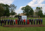
Note to editors: An image of the group who attended the GeoDesign Summit in Redland, California is available for download at http://multimedia.uga.edu/media/images/GeoDesign.jpg.
Caption: UGA students and faculty gather with Lawrie Jordan (center), a UGA CED alumnus and director of imagery at the Environmental Systems Research Institute. He is joined by UGA attendees at the 2012 GeoDesign Summit in Redlands, Calif. Standing left to right are UGA Assistant Professor Alison Bramlet, Associate Director of the Center for Remote Sensing and Mapping Science Thomas R. Jordan, Associate Professor Cari Goetcheus, Jordan, Wes Ryals (MLA 2012) and Megan Turner (MLA 2014).